Thursday, August 31, 2017

The Cabot Trail Experience

The  Cabot Trail is considered one of the world's most scenic destinations, with stunning ocean vistas, old-growth forests, prehistoric rock scarred by glaciers, and the mysterious Cape Breton Highlands. I was fortunate enough to go with a very small tour group - three tourists, one guide - in a van on the "trail." It's advertised as "spend 3 to 5 days exploring the communities and villages and trails along the Cabot Trail," but we did it in 8.5 hours. That included stops for photos and short visits as well as lunch. I would like to have spent a little more time exploring some of the shops of the local artisans, but hey, "next time."

Lost and found bouys and skeletal tuna tails.
Just one of many unique sights along the Cabot Trail

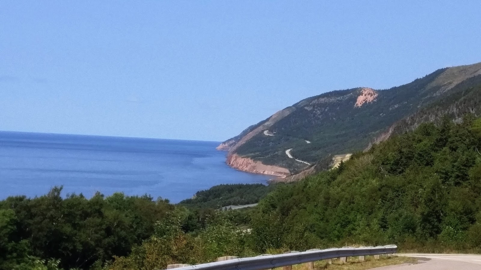
The route measures 298 km (185 mi) in length and completes a loop around the northern tip of the island, passing along and through the scenic Cape Breton Highlands. It is named after the explorer John Cabot who landed in Atlantic Canada in 1497, although most historians agree his landfall likely took place in Newfoundland and not Cape Breton Island. Premier Angus L. MacDonald attempted to re-brand Nova Scotia for tourism purposes as primarily Scottish and, as part of this effort, created both the names Cape Breton Highlands and Cabot Trail.

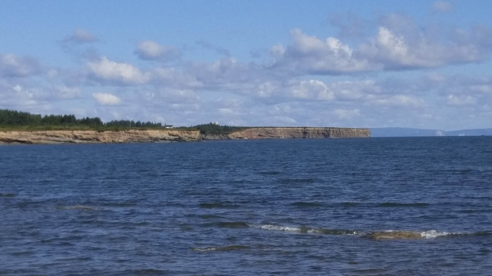
A beautiful view of the Atlantic Ocean from Cabot Trail

There are a number of hikes you can take through this area, including the Skyline Trail, which goes right along the top of a cliff. We saw some hikers doing just that while we were on our tour. You can also bike around the Cabot Trail but I don't know who in their right mind would do that. It is hilly!! There was some construction going on, but I didn't think it was bad at all. And we had no traffic or congestion problems at all. How nice to be someplace at the end of August (end of tourist season) and not have to be following five large tour buses! We only saw one the whole time.


There are a number of wonderful places to pull off the road to take pictures and/or to visit a lodge or interpretive centre. One of my favorite stops was near the beginning, which, for us, was on the East side. I absolutely fell in love with the rocky and rugged shoreline on the East side. The rocks were pink and sparkly! I learned that they are granite, and there is a lot of iron in the soil here, which lends to pinks and reds.


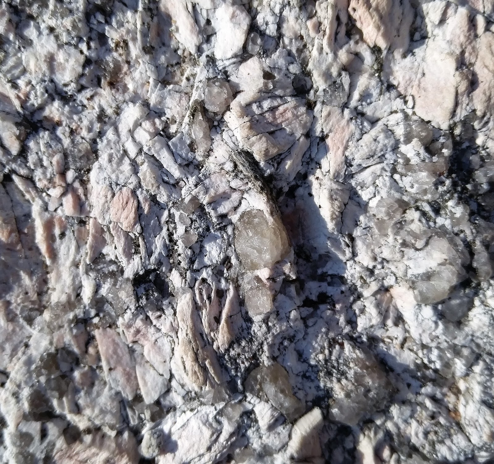
I loved finding this crystal in a boulder. I even tried to
pry it out! 

Our guide (Harry) told us this is granite. You can't tell
by the picture, but in the sunlight it was sparkling!


Beautiful!

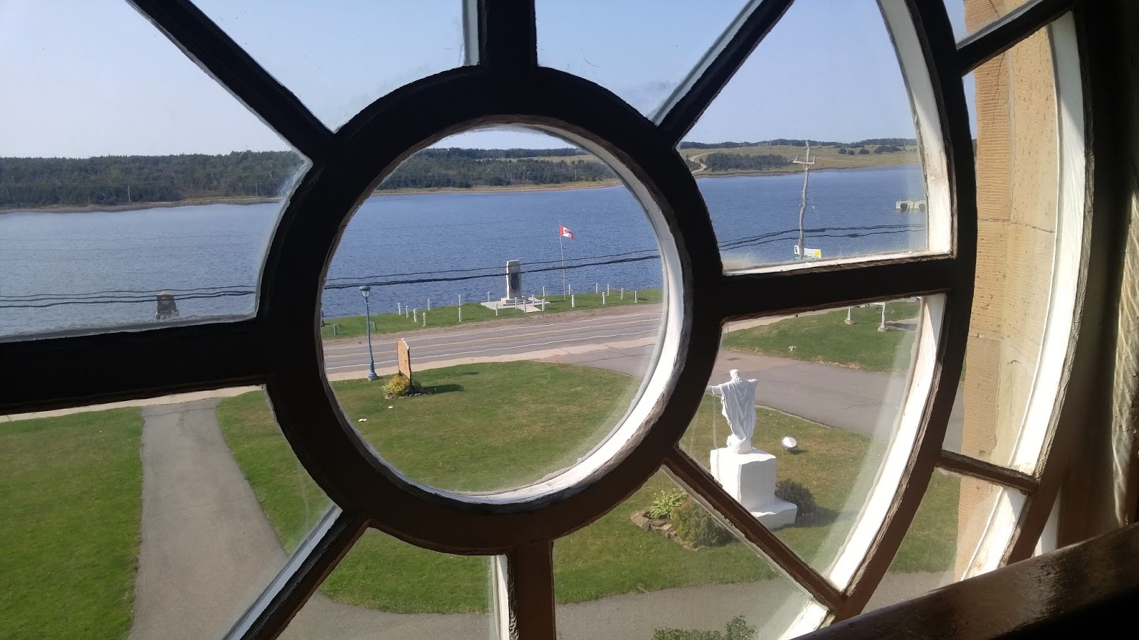
One of our stops was at the Keltic Lodge in Ingonish. It's a beautiful place to stay, at least from the outside and the lobby and gift shop.

Image result for keltic lodge nova scotia
I did not take this picture, but it gives you a great view of where
this lodge is located.


The flowers are front were gorgeous!

Ingonish is a rural community which lies at the eastern entrance of Cape Breton Highlands National Park. The economy relies heavily on tourism and fishing.

Next stop was at Neil's Harbour. Artifacts that have been discovered leads historians to believe that Neil's Harbour was founded by the French. This village is name after Neil MacLennan (very Scottish).

Crab pots for snow crab

Village of Neil's Harbour

Neil's Harbour Lighthouse turned ice cream shop.
We stopped for ice cream. I had this delicious salted
caramel ice cream with large chocolate chunks mixed in!


We stopped for lunch at the Mountain View restaurant where
I ate my very first lobster roll! Our guide likes to stop here
because it's less crowded and they have named a 
fish burger after him - The Harry Burger.
Image result for mountain view lodge and restaurant nova scotia
You can see why it's called Mountain View. This is
Nova Scotia's idea of a mountain.


We continued on around the trail, onward and upward toward Cape Breton Highland National Park - the Highlands. The Scottish tourists say that this part of the Cabot Trail reminds them most of home in Scotland.


Can you almost imagine what those hills will look like when the leaves start to change colors? It would be breath-taking. Some of the trees were just starting to turn, so probably in another month it will be all oranges, yellows, reds and golds. "Next time."


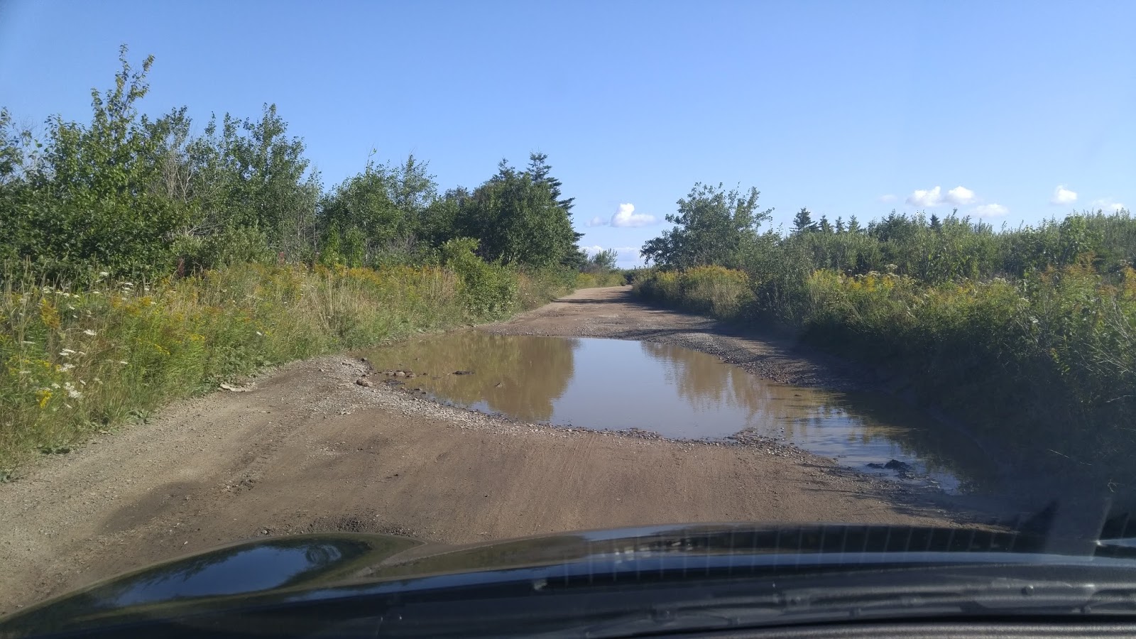
Looking back on the road in which we had just come.
This reminds me a little bit of Central California, Big Sur area.

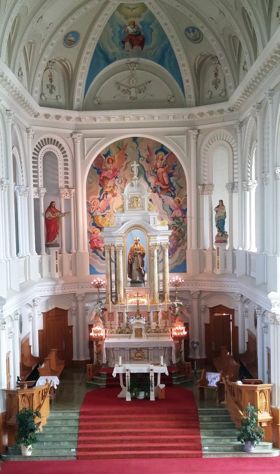
Cheticamp is a fishing community on the west side of the Cabot Trail. The village was established in 1785 and probably has the largest population and information of the Acadian people. It also is the home to a beautiful Catholic church - St. Peter's. St. Peter is the patron saint of fishing.

Looking out the window of the church, towards the 
Cheticamp River, which feeds into the St. Lawrence River.

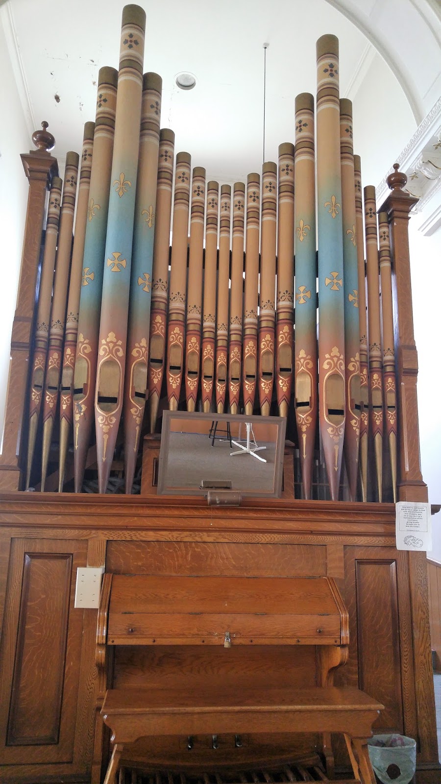
Beautiful pipe organ


After the tour, as I was driving home, I finally decided to stop and take a picture of these very unique signs - unique to Cape Breton. The top is English, the bottom is Gaelic. The Gaelic language appears to be quite complicated to read and to speak, but I love that this area is working to keep this language, and culture, alive.


Wednesday, August 30, 2017

Recommendations Taken

On my second full day on Cape Breton Island, I decided to take some recommendations from the people with whom I dined with for breakfast, and from Jane, the owner of the B&B. It was fun but there was a lot of driving. When you look at a map, it doesn't look like things should be so far away, but this is a larger island than it looks! And there is water EVERYWHERE! To the right, to the left, in front of, and behind . . . the Atlantic ocean, Bras d'Or Lake, bays, rivers, and other lakes. The trees are so green and the water is so blue.

One of the other guests here at the B&B picked up some beach glass at a beach that I'm not even sure had a name. It was definitely out of the way. I actually encountered a large pothole full of water (water everywhere!) and made the decision to zoom through the side of it. It worked! I got through.


I did not find one piece of beach glass, except some recently broken beer bottles, but I did find lots of shells and some of nature's most beautiful beach art.


These were fascinating - very thin rocks kind of sandwiched in-between a couple of boulders.
Most of the beach was rocks, large and small, and a ton of squishy seaweed. I sunk down to my ankles more than once. Eeeewww!

I walked out on these rocks as far as I could. Ran out of rock!


Beautiful view.

The co-owner / chef at The Lobster Pound learned that I liked lighthouses so he told me how to get to one that was not on my list. "Drive to the Seal Island bridge, but don't cross it. Pull off to the side of the road, run across the highway quickly, find the unmarked dirt path, follow it and you will come to McNeil Beach Lighthouse." I was up for the challenge. I only thought about backing out one or two or three times, as I was basically walking through the woods by myself.


I came to the end of the trail, which was directly under the Seal Island bridge, but I saw NO lighthouse! Darn. Climb back up the path, and as soon as I started crossing the bridge I looked over to my left and there it was, and it was pretty. I couldn't pull off onto the side of the bridge, and since it was a major highway, everyone was driving super fast. I had to get to the other side until I could get any kind of view of the lighthouse.


It is to the right of the bridge. Pretty bridge, huh? More water!
Image result for mcneil island lighthouse
Here's a picture I found on the Internet. Pretty little lighthouse. 
Later I found out that it's on an island (go figure) - Boularderie Island.
I thought I was on the mainland!

On the recommendation of Jane (B&B), I drove to the Gaelic College, which was real close to the Seal Island bridge. The Gaelic College is in St. Ann's. Colaisde na GĂ idhlig is first and foremost an educational non-profit institution, offering year-round programming in the culture, music, language, crafts, customs, and traditions of the immigrants from the Highlands of Scotland. Currently, students are able to choose to study from over ten traditional arts, including Cape Breton fiddle, piano, guitar, step-dancing, and piping, highland dancing, weaving, and of course Gaelic language. The only institution of its kind in North America, students of all ages and skill levels visit the College every year to study under some of the finest instructors in Nova Scotia Gaelic culture. 

I love all things Scottish, so it was worth the visit. AND, I got there in time to witness my first ceilidh. How do you pronounce it and what is it? Pronunciation: Kay-lee. Not at all how it looks like it should be pronounced. What an incredibly difficult language to learn. What is it? It's a "visit," a party, gathering, or the like, at which dancing, singing, and storytelling are the usual forms of   entertainment. We got to hear a bagpiper, piano, fiddle as well as watch some dancing and listen to some singing. I'm thinking that if more people would do this kind of "visit" with their friends and neighbors worldwide, we'd have more people find peace and happiness.


This hall is an exhibit on the Scottish people and their culture - music, language, weaving, etc.
All of the halls serve at least two purposes, one of those purposes being dorm rooms.


Love these "washroom" signs.


My first ceilidh! Toe-tapping fun!


Onward down the road, well, quite a ways (thank goodness for GPS and Google Maps), I ended up in Baddeck. This is a fun little village, totally designed for tourists. Lots of quaint hotels and bed & breakfast establishments, some fun shops, a marina, a yacht club (so unpretentious), and restaurants. AND, a lighthouse.


Kidston Light from land.


The village of Baddeck from the end of the wharf.

Kidston Light from the water.

Jane (B&B) recommended that I try and take a sail on the Ameoba so I went to the end of the wharf where they dock. I had just missed the 2:30 sailing, so I waited around - had a lobster lunch - and went back down to catch the 4:30 sail. Well, the 4:30 sail was a private sail, for a tour company, so I was super disappointed. But, one passenger did not show up, so I made it on to the boat! $25 to take a 90 minute sail around Kidston Island and to view Alexander Graham Bell's property and the house in which he lived.

Our pirate captain taking on another pirate captain!

Watching a bald eagle come scoop up some food we threw out into the water,

On Bell's property - a reading room with a westerly view for a great sunset.

Alexander Graham Bell's home. He was born in Scotland, moved to Boston, did not like the heat of Boston, and moved to Cape Breton / Nova Scotia. This house is still in the family and a granddaughter was recently living there. The owner of National Geographic also lives on the property.


Having a good time with a group of very elderly tourists.

I have been having a odd feeling not being able to see the sunset into the water. It feels backwards. Oh, and I just learned on this day that I'm not in the Eastern time zone but in the Atlantic time zone, which is four hours difference from home. Been here three days and did not know that!

Anyway, I went in search of a sunset and found it, where else, at a lighthouse! It took me a little over an hour to get from Baddeck to New Waterford, but it was worth it.


Low Point Lighthouse - one that actually had a working light!


Aaaah! A sunset into the ocean.