Friday, September 1, 2017

Green Gables Shore Drive

Anne of Green Gables is a 1908 novel by Canadian author Lucy Maud Montgomery (published as L. M. Montgomery). Written for all ages, it has been considered a children's novel since the mid-twentieth century. It recounts the adventures of Anne Shirley, an 11-year-old orphan girl who is mistakenly sent to Matthew and Marilla Cuthbert, a middle-aged brother and sister who had intended to adopt a boy to help them on their farm in the fictional town of Avonlea on Prince Edward Island. The novel recounts how Anne makes her way with the Cuthberts, in school, and within the town.
Since its publication, Anne of Green Gables has sold more than 50 million copies and has been translated into at least 36 languages. Montgomery wrote numerous sequels, and since her death, another sequel has been published, as well as an authorized prequel. The original book is taught to students around the world. (from Wikipedia)
That being said, I never read the book, and just before I left on vacation I watch one version of the movie, with Martin Sheen playing the "middle-aged brother." 
Lucy Maud Montgomery was born on the north shore of Prince Edward Island in 1874 and raised in Cavendish by her grandparents. It was here that she penned her most famous novel. Lucy Maud never actually lived in the green gables house sitting on the property that tourists visit. She visited the farm as a young girl and based the Green Gables in her novel on the house and the real life surrounding areas such as The Haunted Woods and Lover's Lane. We the tour group I was with) did not have a whole lot of time at this attraction, but I had a lot of fun hanging with a woman (Joan Lindsay Kerr) who had been waiting 11 years to get to Green Gables. She grew up reading the books - yes, multiple Anne stories - and she was so excited to finally get to the Prince Edward Island Green Gables house. We walked for a little bit on the Lover's Lane path, and I took pictures of her in front of the house and with Anne and her best friend Diane (it was like Disneyland for Joan!). 


It wasn't all the exciting to me because I'd never read the books, but after spending time with my new friend Joan and watching a seven minute video on Lucy Maud and her history of writing, it was an altogether pleasant experience.
I made two other friends on the tour - Ulee and Martina. They came on the cruise ship from Germany. They knew even less about Anne of Green Gables than I did, so we had a few good laughs.
Our tour bus made a quick stop for us to get out and take some pictures of the red rocks in the Cavendish area. The picture where you can see a beach in the distance is Cavendish Beach and yes, there were quite a lot of swimmers in the ocean - the cold Atlantic ocean! Actually, it's the Gulf of St. Lawrence, and our guide told us that it's warmer than normal due to the gulf stream.


The tour was called The Green Gables and Shore Drive tour, so we did see more than just the Green Gables site. We saw some beautiful scenery and stopped at the Prince Edward Island Preserve Company. They make their jams / jellies / preserves / salsas on-site, and they had a tasting counter to rival many tasting counters. It is located in New Glasgow, which is a very pretty little valley next to the Hunter River.
Image result for prince edward island preserve company
Raspberry with Champagne was my absolute favorite of the tasting so I bought a jar. 
No, make that two jars!


The grounds and gardens around the Preserve Co. were so beautiful.


Before our tour headed north to the Green Gables Shore Drive, our guide took us around old Charlottetown. While we were following the waterfront boardwalk, Joan pointed out the lighthouse as we passed it. I have absolutely no idea which lighthouse it is as there seem to be quite a lot of harbour lights in Charlottetown and vicinity, and it looks like all the other Canadian harbour lights.


Joan recommended The Merchantman restaurant, so I dined there this evening. I needed to lighten up from all the rich and fried food I'd been eating, so I had a shrimp Casear salad and this absolutely scrumptious berry tart. The crust on that tart was the lightest, most moist crust I have ever tasted. Sorry Grandma Lewis.


Island Hopping

It was time to say goodbye to Cape Breton Island on Wednesday, and was already missing it by Wednesday night.

It took me a couple of hours to drive off Cape Breton Island and back onto mainland Nova Scotia and over to Caribou to catch the ferry. The ferry ride was a little over an hour, but what a cool ferry!


See any cars? Nope. That's because they are "inside" the ferry. The end on the right opens up like some kind of space capsule and cars drive on to the main deck OR down, into the belly of the ferry. I went down and it was weird. There were 5 lanes of cars, the length of the ferry on that bottom deck. I kind of got lost trying to find my car when it was time to get ready to disembark! There are three decks above the two car decks, and one deck had a very nice cafe . . . with live music. Way to go Northumberland Ferry Ltd.!

I was busy eating when the announcement came over the loudspeaker to get back to our cars, so as I stood up to get going I looked out the window and saw this -


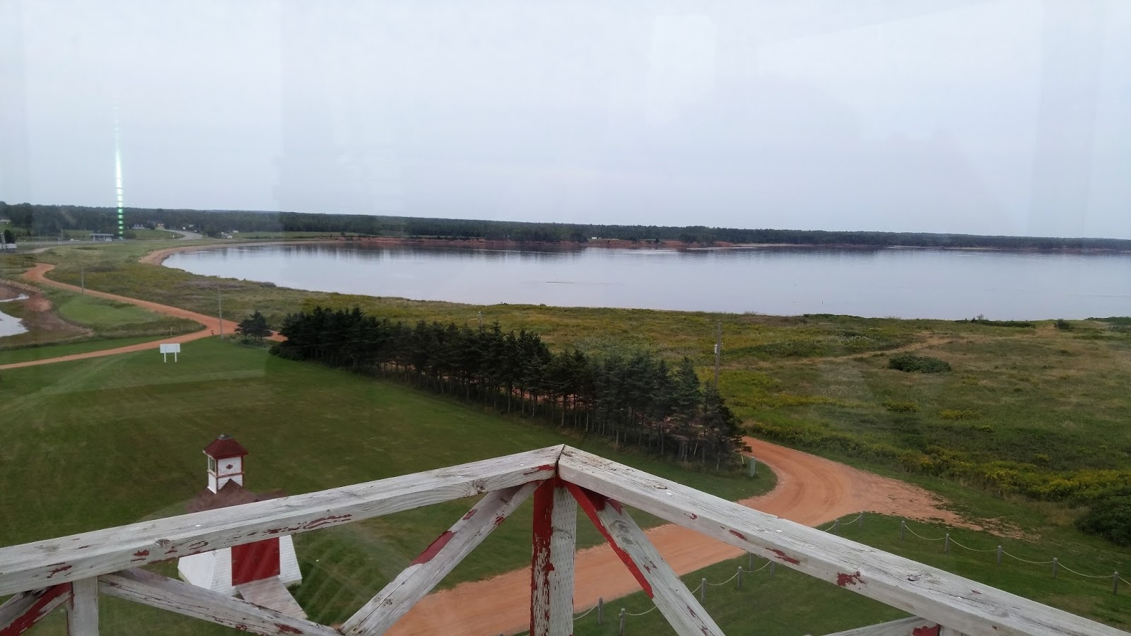
Yep, I almost missed it. It's the Wood Islands Lighthouse. Actually, there are three lights - the main lighthouse, and the one to the right that you can see (a range or harbour light) and another one behind the main lighthouse (another range/harbour light). When I saw how close it was to the ferry terminal, I was excited. LOVE the red dirt cliffs.


It was nice to be able to climb up one of these Canadian lighthouses. It's different as they are not as tall, and most of the stairs look like this instead of the winding metal staircases I'm used to in the West coast lighthouses.


Made it!


And that is the reason why I won't be visiting all of the Prince Edward Island lighthouses. I might get to eight of them . . . maybe.


Beautiful scenery on every drive. I headed further east in search of the Cape Bear Lighthouse. The thing about lighthouse hunting is that it's not quick. Lighthouses that are out on points of land mean taking the main road for awhile, then turning off onto the road that goes to the point, which can be anywhere from 2km to 15km, and then you have to go back out that road to get to the main road. Patience is a virtue in lighthouse locating.


Cape Bear Lighthouse

Most of these Canadian lighthouses have been decommissioned, but the communities in which the lighthouse reside pull together their resources and keep the lighthouses maintained, and staff on a voluntary basis or have received a grant to stay open and run a gift shop or small tours. They are doing a great job and I've met a lot of wonderful small-town, passionate-about-preservation people.


Cape Bear Lighthouse is northeast from the ferry terminal and Point Prim Lighthouse (above) is southwest from the ferry terminal, so it was a bit of a drive from Cape Bear to Point Prim. But it was worth it because look!!  This one is ROUND! Finally! 


Love this shot with the sun in the background.

A long drive, a ferry ride, and three lighthouses in one day? Yep. I was ready to call it a day. So I checked into the Sonata Inn in Charlottetown (another hour from Point Prim Lighthouse) and headed out for a bit to eat. Fish and chips sounded good. The menu had the choice of one fillet or two and the server told me that one was plenty big. NO KIDDING! Yes, despite the fact that it looks like two cod filet, it was just one. And it was the greasiest fish and chips I've ever eaten. Great batter though and yummy tarter sauce.


The Sonata Inn looked quaint enough on their website, but it's just not the same as the fabulous place I stayed in Cape Breton. In fact, the Sonata Inn feels like a hotel. The building is 149 years old, but the rooms are very contemporary. And breakfast is just not the same, although I like the set up - you can go eat buffet style any time between 7:30 and 10:00 a.m. The people here are really nice and it's located in the historic part of Charlottetown, which is really cool.


Thursday, August 31, 2017

The Cabot Trail Experience

The  Cabot Trail is considered one of the world's most scenic destinations, with stunning ocean vistas, old-growth forests, prehistoric rock scarred by glaciers, and the mysterious Cape Breton Highlands. I was fortunate enough to go with a very small tour group - three tourists, one guide - in a van on the "trail." It's advertised as "spend 3 to 5 days exploring the communities and villages and trails along the Cabot Trail," but we did it in 8.5 hours. That included stops for photos and short visits as well as lunch. I would like to have spent a little more time exploring some of the shops of the local artisans, but hey, "next time."

Lost and found bouys and skeletal tuna tails.
Just one of many unique sights along the Cabot Trail

The route measures 298 km (185 mi) in length and completes a loop around the northern tip of the island, passing along and through the scenic Cape Breton Highlands. It is named after the explorer John Cabot who landed in Atlantic Canada in 1497, although most historians agree his landfall likely took place in Newfoundland and not Cape Breton Island. Premier Angus L. MacDonald attempted to re-brand Nova Scotia for tourism purposes as primarily Scottish and, as part of this effort, created both the names Cape Breton Highlands and Cabot Trail.

A beautiful view of the Atlantic Ocean from Cabot Trail

There are a number of hikes you can take through this area, including the Skyline Trail, which goes right along the top of a cliff. We saw some hikers doing just that while we were on our tour. You can also bike around the Cabot Trail but I don't know who in their right mind would do that. It is hilly!! There was some construction going on, but I didn't think it was bad at all. And we had no traffic or congestion problems at all. How nice to be someplace at the end of August (end of tourist season) and not have to be following five large tour buses! We only saw one the whole time.


There are a number of wonderful places to pull off the road to take pictures and/or to visit a lodge or interpretive centre. One of my favorite stops was near the beginning, which, for us, was on the East side. I absolutely fell in love with the rocky and rugged shoreline on the East side. The rocks were pink and sparkly! I learned that they are granite, and there is a lot of iron in the soil here, which lends to pinks and reds.


I loved finding this crystal in a boulder. I even tried to
pry it out! 

Our guide (Harry) told us this is granite. You can't tell
by the picture, but in the sunlight it was sparkling!


Beautiful!

One of our stops was at the Keltic Lodge in Ingonish. It's a beautiful place to stay, at least from the outside and the lobby and gift shop.

Image result for keltic lodge nova scotia
I did not take this picture, but it gives you a great view of where
this lodge is located.


The flowers are front were gorgeous!

Ingonish is a rural community which lies at the eastern entrance of Cape Breton Highlands National Park. The economy relies heavily on tourism and fishing.

Next stop was at Neil's Harbour. Artifacts that have been discovered leads historians to believe that Neil's Harbour was founded by the French. This village is name after Neil MacLennan (very Scottish).

Crab pots for snow crab

Village of Neil's Harbour

Neil's Harbour Lighthouse turned ice cream shop.
We stopped for ice cream. I had this delicious salted
caramel ice cream with large chocolate chunks mixed in!


We stopped for lunch at the Mountain View restaurant where
I ate my very first lobster roll! Our guide likes to stop here
because it's less crowded and they have named a 
fish burger after him - The Harry Burger.
Image result for mountain view lodge and restaurant nova scotia
You can see why it's called Mountain View. This is
Nova Scotia's idea of a mountain.


We continued on around the trail, onward and upward toward Cape Breton Highland National Park - the Highlands. The Scottish tourists say that this part of the Cabot Trail reminds them most of home in Scotland.


Can you almost imagine what those hills will look like when the leaves start to change colors? It would be breath-taking. Some of the trees were just starting to turn, so probably in another month it will be all oranges, yellows, reds and golds. "Next time."


Looking back on the road in which we had just come.
This reminds me a little bit of Central California, Big Sur area.

Cheticamp is a fishing community on the west side of the Cabot Trail. The village was established in 1785 and probably has the largest population and information of the Acadian people. It also is the home to a beautiful Catholic church - St. Peter's. St. Peter is the patron saint of fishing.

Looking out the window of the church, towards the 
Cheticamp River, which feeds into the St. Lawrence River.

Beautiful pipe organ


After the tour, as I was driving home, I finally decided to stop and take a picture of these very unique signs - unique to Cape Breton. The top is English, the bottom is Gaelic. The Gaelic language appears to be quite complicated to read and to speak, but I love that this area is working to keep this language, and culture, alive.